Insider Brief
- SandboxAQ introduced AQNav, a technology designed to aid navigation when global positioning satellite (GPS) systems are jammed or not available.
- AQNav has logged more than 200 flight-hours and more than 40 sorties across multiple regions of the world on four different aircraft types.
- The system relies on proprietary AI algorithms, powerful quantum sensors, and the Earth’s crustal magnetic field.
PRESS RELEASE — After development and testing with leading government and private sector partners, SandboxAQ is officially announcing AQNav, a breakthrough technology designed for navigation across air, land and sea when Global Positioning Satellite (GPS) systems are jammed or not available. To date, AQNav has logged more than 200 flight-hours and more than 40 sorties across multiple regions of the world on four different aircraft types, ranging in size from single-engine planes to large military transport aircraft.
AQNav is a geomagnetic navigation system that leverages proprietary AI algorithms, powerful quantum sensors, and the Earth’s crustal magnetic field. AQNav will provide an unjammable, all-weather, terrain-agnostic, real-time navigation solution in situations where GPS signals are unavailable, denied, or spoofed.
Beyond disrupting transportation and logistics, GPS interference also impacts a broad range of industries, including agriculture, financial services, and public infrastructure and safety systems, such as environmental monitoring, utilities and roadway management, and disaster response.

“GPS is a ubiquitous tool that billions of people rely on every day for their comfort, safety, security and prosperity. The intentional disruption of this transformational technology by nation-states and others puts human lives at risk and impacts governments and economies,” said Jack D. Hidary, CEO of SandboxAQ. “Working closely with our public- and private-sector partners, SandboxAQ has used AI and quantum tech to create a safe, secure navigation alternative to supplement GPS, and we’re proud to make our breakthrough AQNav system widely available to companies and governments around the world.”
Groundbreaking Technology Takes to the Skies
In January 2023, the U.S. Air Force (USAF) awarded SandboxAQ a Direct-to-Phase-II Small Business Innovation Research contract to explore geomagnetic navigation. By May 2023, the company successfully completed the first flight tests of AQNav – eight months ahead of schedule – during Exercise Golden Phoenix. The system was also flight-tested in August 2023 during Exercise Mobility Guardian – Air Mobility Command’s largest exercise ever at the time.
General Mike Minihan, Commander, Air Mobility Command (AMC), of the US Air Force stated, “We must embrace the realities of what it will take to maneuver the Joint force in a degraded and contested environment. Improving the Mobility Air Force’s navigation is one of the four major gaps we have focused on closing. Doing so requires innovative technological solutions to improve survivability and extend our ability to deliver victory.”
In addition to the USAF, SandboxAQ is engaged with several aerospace leaders, including other allied governments as well as Boeing and Acubed – the Silicon Valley research and innovation center of Airbus. All have used the system on test flights in many different geographies across the globe.
How AQNav Works
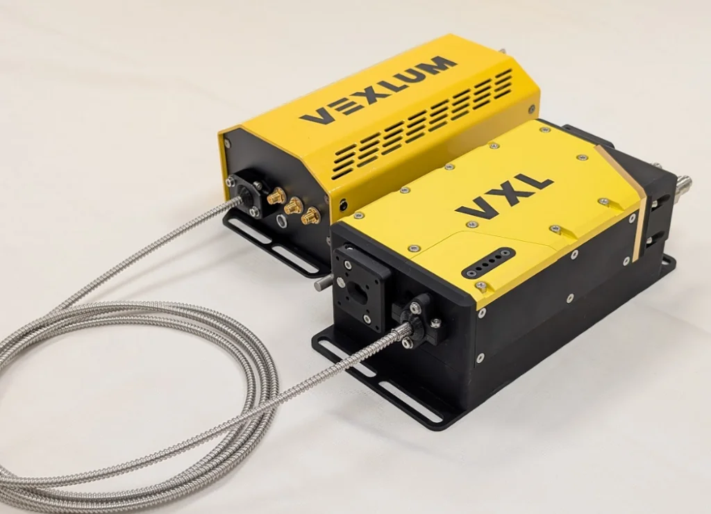
AQNav uses extremely sensitive quantum magnetometers to acquire data from Earth’s crustal magnetic field, which exhibits geographically unique patterns – similar to a human fingerprint. AQNav uses AI algorithms to compare this data against known magnetic maps, enabling the system to quickly and accurately find its position. Due to the high sensitivity of quantum sensors, AI algorithms are applied to improve the signal-to-noise ratio, removing any mechanical, electrical, or other interference that would impact the system’s ability to acquire its location.
“GPS is easy to jam and spoof. When planes and ships lose GPS in motion and switch over to inertial navigation systems, the vehicle then drifts and soon finds itself off course. The Earth’s crustal magnetic field provides a persistent, passive external signal, making it a highly reliable data source for navigation in concert with other inertial and other sources,” said Luca Ferrara, General Manager of Navigation at SandboxAQ. “AQNav works with existing navigation systems, including inertial, visual, satellite, and other emerging technologies, creating a robust and resilient system-of-systems that will improve navigational accuracy and safety for our customers.”
“GPS denial, jamming and spoofing have become growing global concerns that jeopardize aircraft and passenger safety, disrupt other commercial and military operations, and affect the reliability of essential services,” said Dana Goward, President of the Resilient Navigation and Timing Foundation. “As the world’s dependence on GPS continues to increase, it is imperative that resilient, robust, and complementary GPS alternatives be implemented to mitigate the economic and security repercussions of interference.”
AQNav offers worldwide availability and the approach can be applied in all domains, including air, land, and sea. The system doesn’t rely on visual ground features or satellite transmissions to function and is not affected by weather conditions. AQNav operates at room temperature, requires no shielding, and has a small form factor that can be integrated into a wide variety of platforms, from multi-engine airliners to unmanned aerial vehicles. Its passive technology emits no electronic signals, which reduces the aircraft’s detectability.
AQNav increases useful navigation for aircraft navigating within the frameworks of regulatory bodies such as the International Civil Aviation Organization and U.S. Federal Aviation Administration’s established area navigation and performance-based navigation concepts. SandboxAQ and its partners are exploring a broad range of use cases that utilize this core functionality for both commercial and defense applications.
Admiral John Richardson (retired), former Chief of U.S. Naval Operations, said, “One of the most important advances in modern warfare has been the ability to act with precision in both time and space. This is enabled by near-ubiquitous, satellite-provided signals like GPS. Everybody understands that this is the first point of attack – how to disrupt the enemy’s ability to use GPS and similar systems. Recent conflicts in Ukraine and Gaza have shown this to be true. Systems like AQNav are absolutely essential to address this critical vulnerability. As a military and as a nation, we must mature these systems that allow us to maintain precision in a GPS-denied environment. It’s fundamental to the way we conduct war.”
Future AQNav Use Cases
In addition to improving civilian, commercial and military aviation, AQNav’s underlying approach could also be used to improve autonomous vehicle control and can operate underwater or underground where GPS signals cannot reach.

